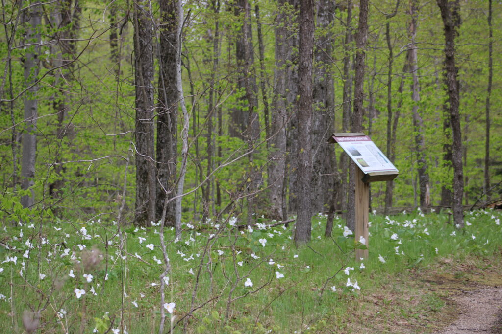
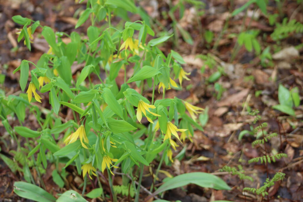
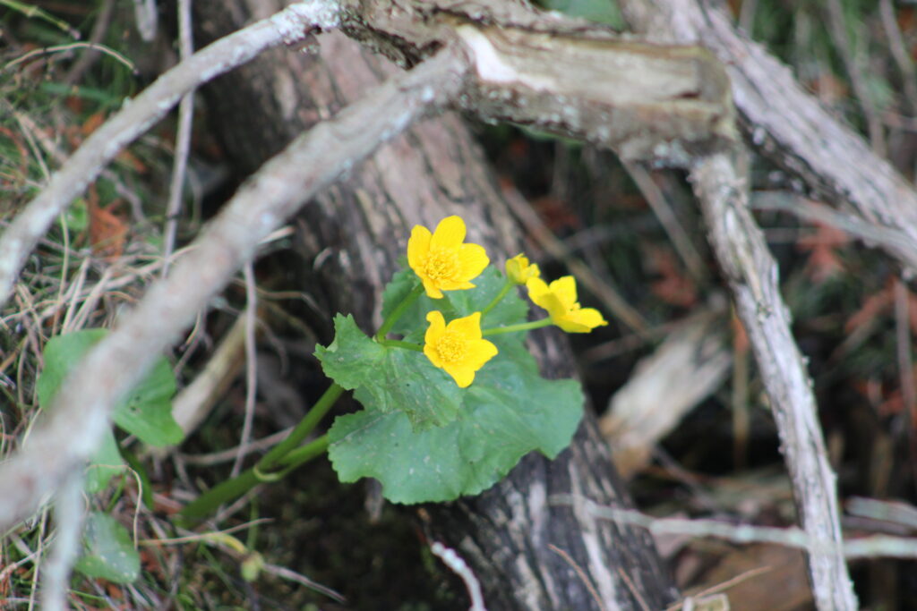
After a break for Mothers day my wife suggested we go to a trail she heard about on the local news. The Logan Creek Natural Area was highlighted on the news because of the flowers that were blooming in advance of the leaves coming out on the trees. What we found on this trail was more than just a forest full of flowers.
Key Features
- Significant Riparian Corridor: Logan Creek flows through the area, creating a valuable riparian habitat as it empties into the lake.
- Undeveloped Natural Landscape: Unlike some other areas in Door County, Logan Creek State Natural Area retains a wild and relatively undisturbed character.
- Important Fish Spawning Habitat: The creek provides crucial spawning grounds for various fish species that utilize Lake Michigan.
- Diverse Native Plant Communities: The area supports a variety of native plant communities, including forests, wetlands, and shoreline vegetation.
- Opportunities for Hiking and Nature Observation: Visitors can enjoy hiking along trails and observing the natural flora and fauna of the area.
- Part of the Niagara Escarpment: The natural area lies along the prominent Niagara Escarpment, a significant geological feature.
- Potential for Birdwatching: The diverse habitats attract a variety of bird species, making it a worthwhile location for birdwatching.
- Preservation of Natural Processes: The designation as a State Natural Area aims to protect the natural ecological processes occurring within the landscape.
- Access to Quiet Natural Beauty: It offers a less crowded and more tranquil experience compared to some of the more heavily visited tourist spots in Door County.
Review
Logan Creek Natural Area is about an hour and a half north east of Green Bay Wisconsin. Follow Highway 42 out of Green Bay to just north of Sturgeon Bay then turn left on Highway 57. On the trip you will see lots of signs for other natural areas, like White Fish Dunes State Park. However there is no sign for Logan Creek Natural Area. In fact if you see the sign on the bridge over Logan Creek you have gone too far.

Yesterday that bridge was under construction so we were able to see the turn off of Highway 57. But the sign for parking was confusing. The sign indicated that the Natural Area was called The Ridges at Logan Creek. Now this may mean it has some connection with The Ridges Sanctuary near Baily’s Harbor another 20 minutes further north. I have not found a link between the properties in my research.
We arrived at the property at around 10 AM. The parking lot was gravel and three other cars were already parked. No other hikers were in sight though.
We exited our car and started getting ready for a hike. I changed my shoes and pulled out some rain gear to protect my camera. My wife pulled pulled out a hoody to protect from the chill. Unlike the rest of the week where temperatures were in the 80s, Saturday started out in the 50s.

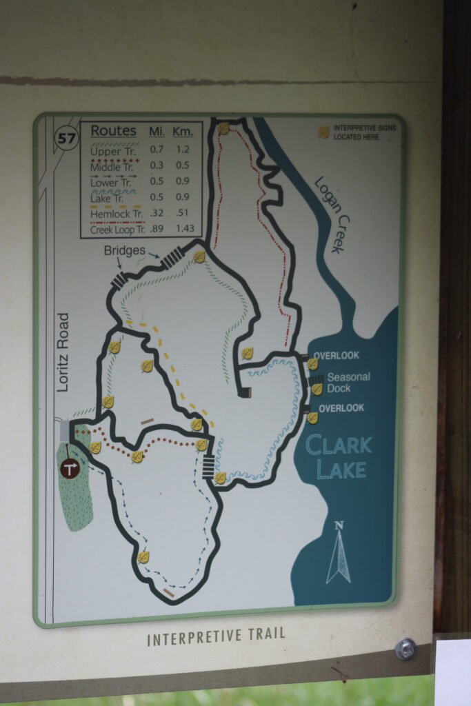
We walked over to the trail head and found a sign with the trail rules. The sign also had a map of the trails. Normally I don’t post the trail maps because the maps are clearly posted on the website I link at the top. Up to this date I have not found a site with a map as good as what was posted at the trail head. View the trail map below.
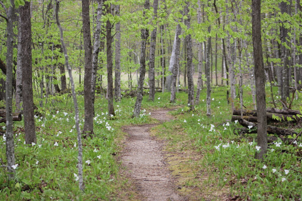
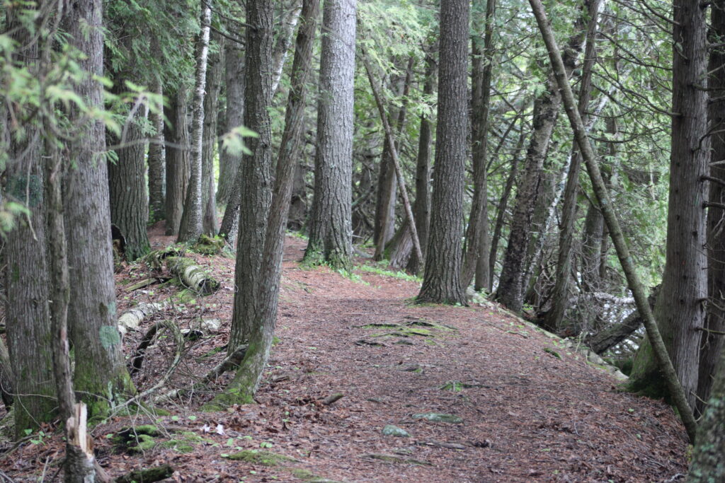
The trails at Logan Creek are rough to say it nicely. While most of the trails I have reviewed are either paved or well groomed, these trails looked like over glorified foot traffic. At the start of the trails there is an effort by the DNR to lay down pea gravel, but the trails vary from a foot wide to three feet. For most of the highland trails this remains true. There are even a few board walks, old and new, constructed over streams and marshy areas.

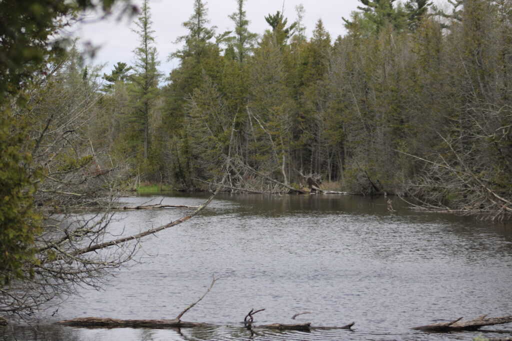
As you get closer to Clark Lake and Logan Creek the trails get worse. The pea gravel disappears and the trails are trampled leaf clutter and wet dirt. For the most part I was able to keep my feet dry during the walk down to the lake. Along the lake the trail follows a small bank of rock and dirt that separated the cedar marsh from the lake.

A few docks and viewing decks have been built along the lake. They provide excellent places to view waterfowl visiting the lake. Yesterday though the isolated rain showers kept most of the birds hunkered down in their nests.
As the trail left the lakeside we encountered one of the many trail maps. As much as I can say the trails are rough, the DNR does take great measures to make sure you know the path. Trail maps at each of the intersections give you a good marker where you are on the trail. Even the rough areas of the path have either ribbons tied to trees or limbs lining the path.
We took a brief side trip to see a scenic overlook. Unfortunately that overlook was in the process of being rebuilt so we returned to the outer trail we planned to follow.
At this point the trail got rougher than before. It followed Logan Creek north from the lake. In this area the trail follows the riparian habitat surrounding the creek. Now prior to researching this trail I had never heard of riparian habitat before. This term means the area surrounding a body of water that is often marshy. This area serves as a flood barrier and filters toxins from the waters that flow through it.

Walking up along the creek we had to hop over saturated areas of the path. A dock we encountered was dilapidated and water soaked. I needed to stand near the edges of the dock for fear of putting my foot through the plywood decking.

As we neared the northern edges of the trail we started to climb out of the marsh. The trail got dry and eventually the pea gravel returned. We started back south and the trail split the division of the cedar marshes and white pine plantations. Eventually the Beach and Birch forests that surround the trail head.

The reason these trails were highlighted by the local news were the flowers. Most of which were in the highland forests around the trail head. If these are what you are looking to see and the difficulty of the trails make you want to shy away, then stick to the short loop near the parking lot. These trails are fairly easy and like most of the trails I have reviewed. The rest of the trails I would consider intermediate difficulty.

Logan Creek is a site that is starting to become a good place to hike. With the DNR replacing the scenic overlook and boardwalks eventually these trails could be for everyone. To make these upgrades to the trail system there is a trail fee of 5 dollars at your honor.

If your looking for something different to do in Door County look this place up. Its an adventure at least and I know we will return in the future.

Please leave a comment below if you’ve ever been to or plan to visit Logan Creek Natural Area. And thank you again for reading my blog.
I love board walks. Great post this week.
Trails barely look present. Seems very isolated. Love those kind of trails. So peaceful.