This week we walked Apple Creek Trail in Appleton WI. A few blog posts ago I talked about the Thrivent loop section of the Apple Creek Trail. This week we went the other direction.
Key Features
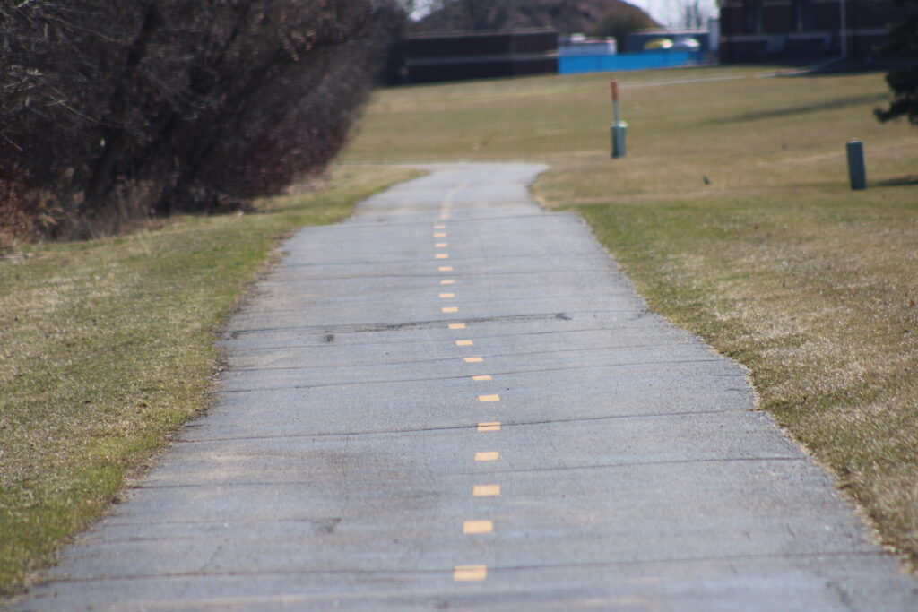
- Paved Asphalt Surface: The trail primarily features a smooth, paved asphalt surface, making it accessible for various activities.
- Multi-Use Trail: It’s designed for multiple uses, including biking, jogging, walking, rollerblading, and dog walking.
- Scenic Views: The trail offers scenic views of Apple Creek, surrounding wetlands, and various natural landscapes.
- Wildlife Observation: Opportunities to observe wildlife, including waterfowl like ducks, geese, and blue herons.
- Length: The trail spans approximately 3.9 miles, offering a considerable distance for recreation.
- Amenities: Benches and trash receptacles are placed at intervals along the trail for convenience. Portable restrooms are also available.
- Accessibility: The paved surface contributes to its accessibility for various users, including those with strollers or wheelchairs.
- Connection to Nature: The trail winds alongside Apple Creek and through natural areas, providing a connection to nature.
- Variety of Landscapes: The trail passes through various landscapes, including prairie areas, farm fields, and wooded areas.
- Connections: The trail has connections to other areas, including the Thrivent Financial complex, and other area trails.
Review
Once again we started the trail by parking at the park and ride off of Ballard. The day started out cool but nice weather, with a partially cloudy sky. We crossed Evergreen Dr and started east on the trail.
Apple Creek Trail follows Apple Creek east from Ballard Dr to Highway JJ or Edgewood Dr. Leading behind apartment complexes, sports parks and housing developments, Apple Creek creates a natural habitat for birds.
The trail is broken up into sections by road crossings. The first section runs from Ballard Dr to Lightning Dr. Trees have grown up along this section of the trail providing a wooded habitat for song birds. As we started along this section of the trail birds flitted through the trees.
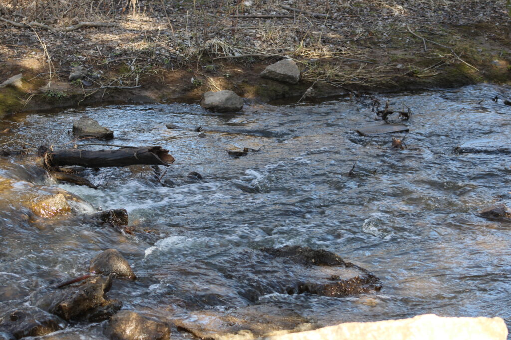
A yellow line ran down the trail providing lanes for the users of the path. Several joggers passed us as we walked and observed nature. We heard a Mallard swimming in the stream and I tried to snap a few photos. We found a small path to sit near the creek and the duck flushed out of the area.
Continuing on past Lightning Dr, the section between Lightning Dr and Providence Ave is more of the same. Tree lining the creek separating apartment complexes from houses. A cardinal paced us as we walked and a squirrel barked at us for interrupting his day. More joggers passed us as we walked.
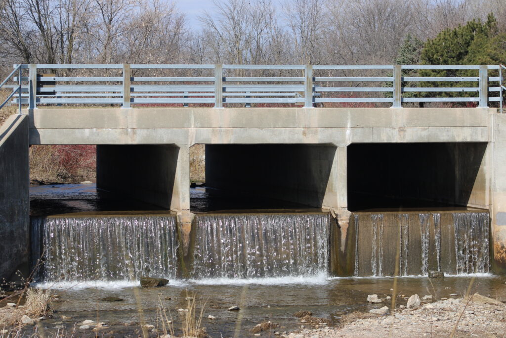
Once we crossed to Providence Ave the creek changed. Culverts leading under Providence Ave end in a small drop creating a small waterfall in the creek. After that the wild trees were cleared away, and newly planted trees lined the trail.
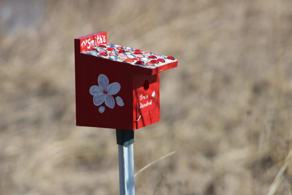
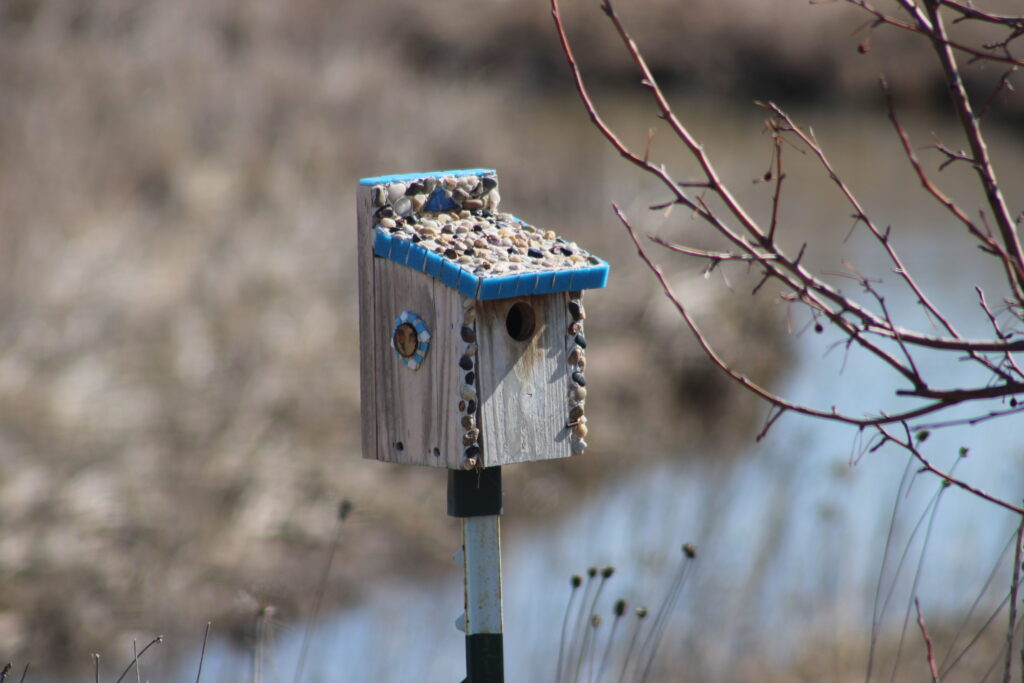
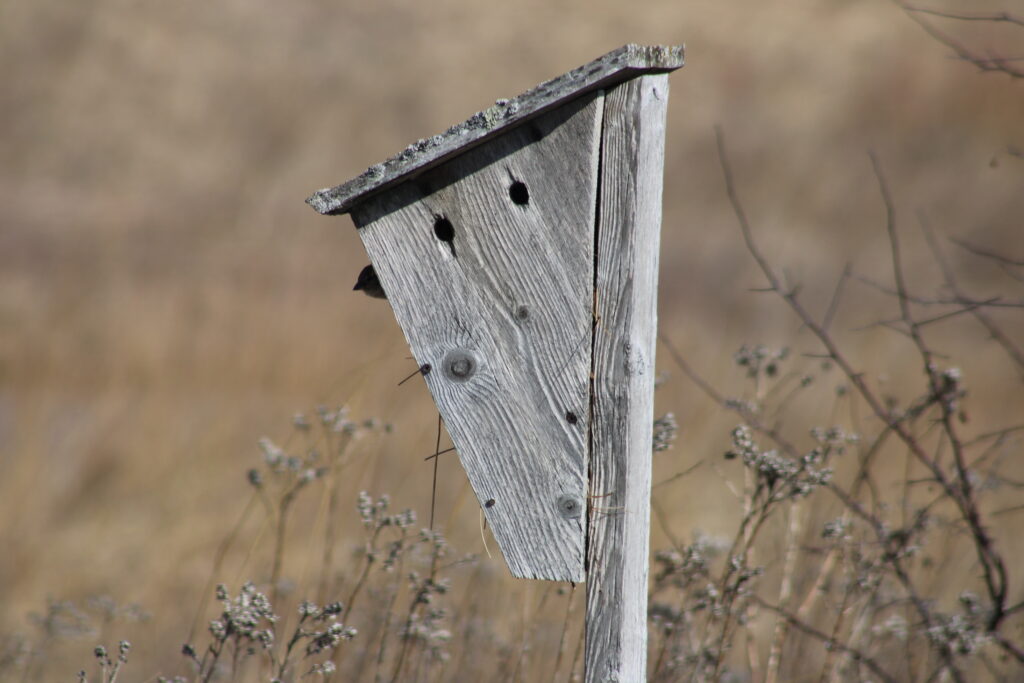
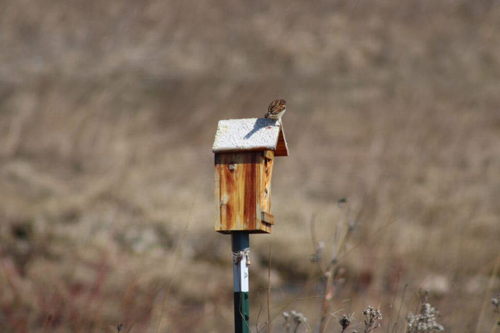
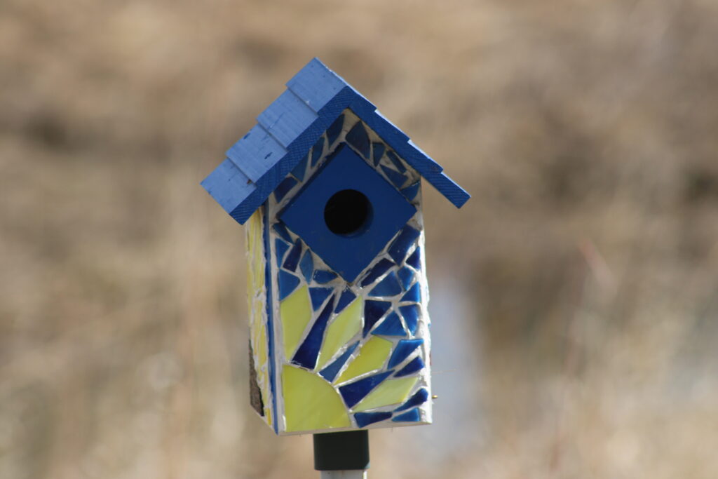
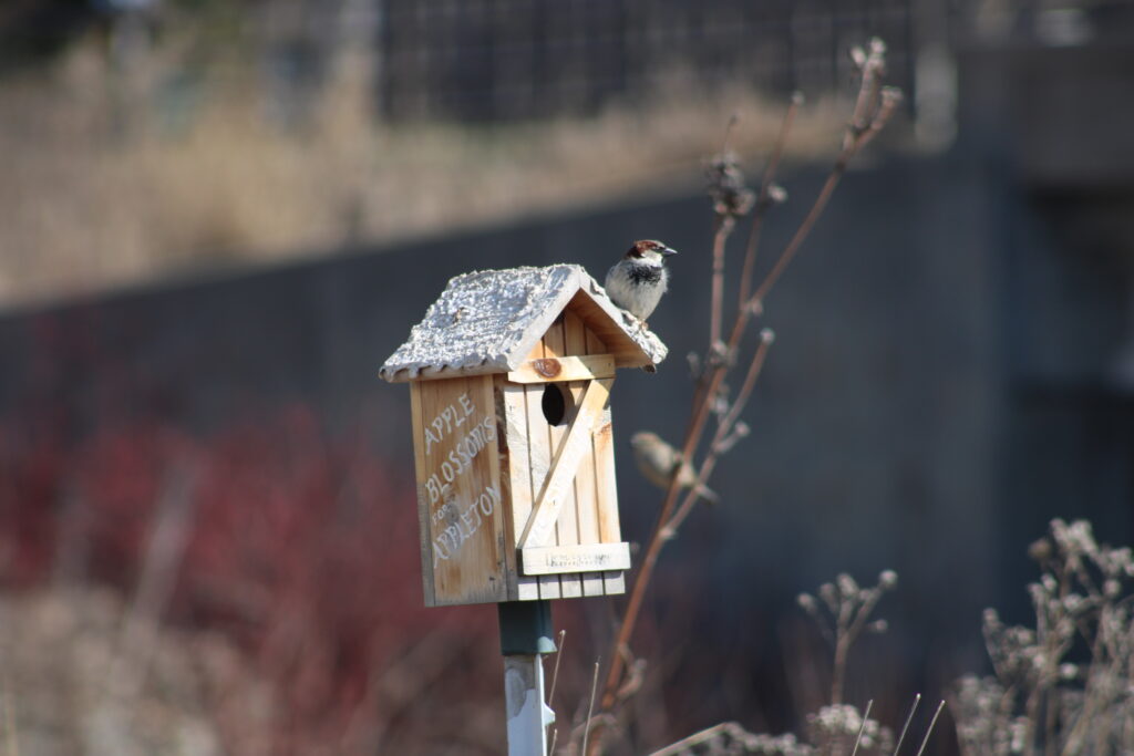
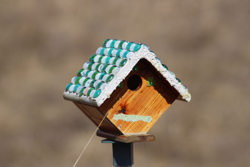
However the unique thing about this section was the Bird houses that also lined the edge of the trail. These houses were of varied shapes and sizes. Some of which looked as though the city had put them up years ago.
Other bird houses looked like local people put them up. These houses had different shapes, sizes and decorations. In either event the local song birds where using or planning to use them in their mating rituals.
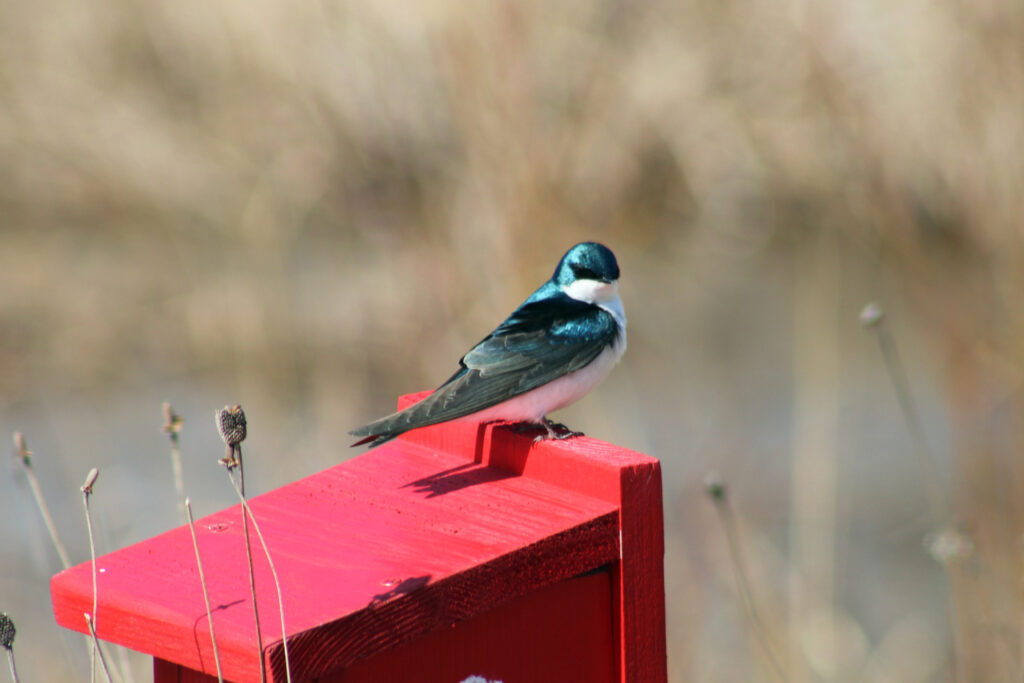
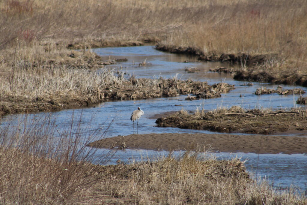
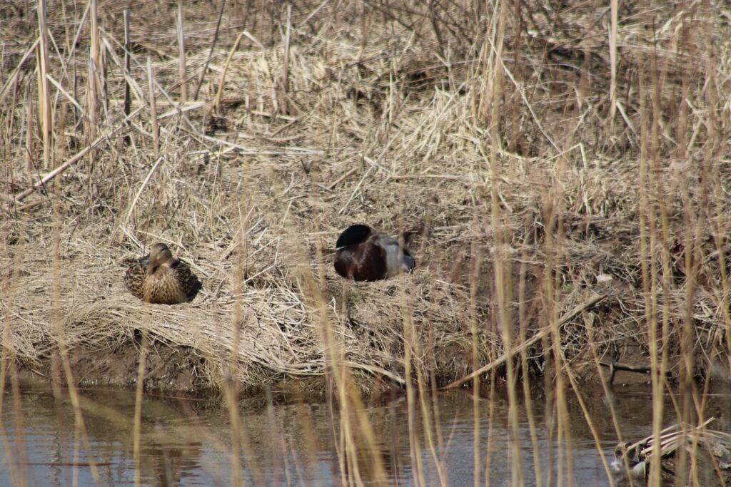
In the creek between Providence Ave and French Rd, we saw a Sand Hill Crane, mating pair of Ring Necked Ducks, and more Mallards. House Sparrows and Tree Swallows hung around the fancy Bird houses. Robins and Black birds flew around the sports park to the south of the trail.
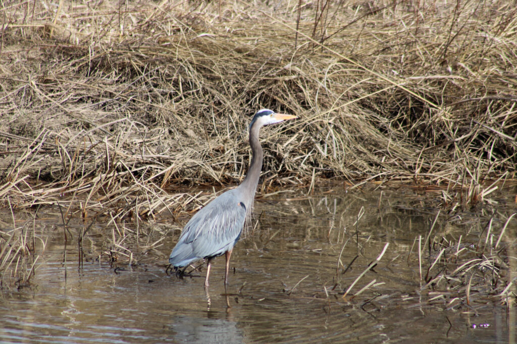
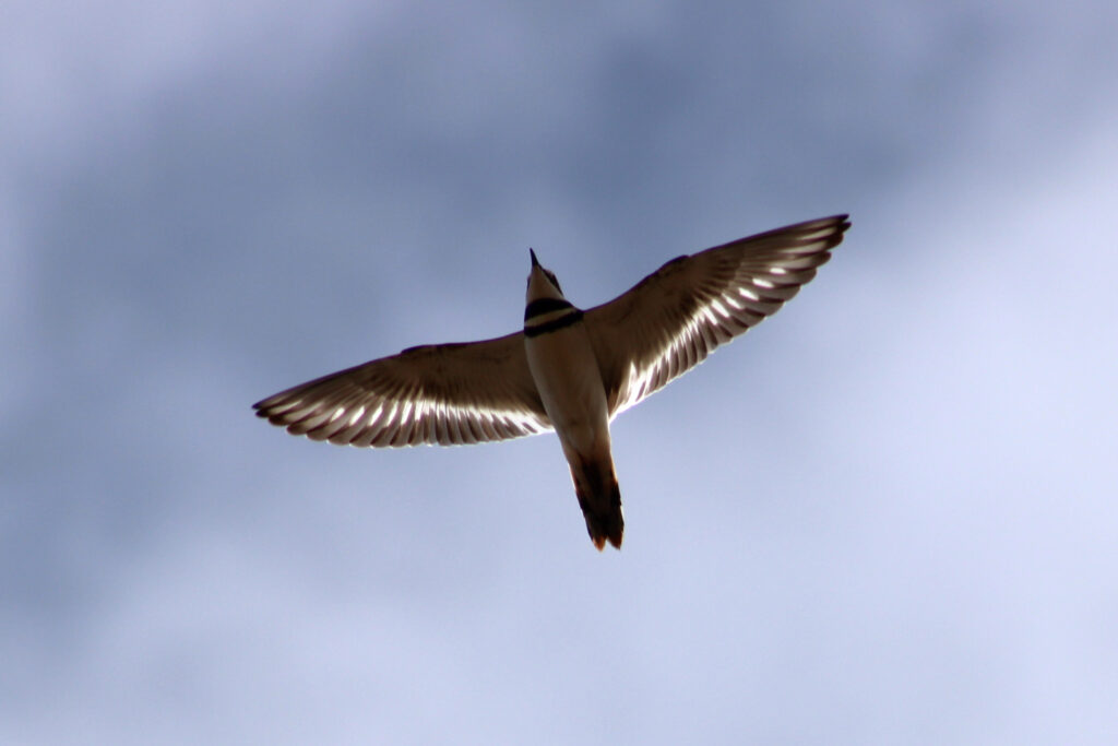
From French Rd and Cherryvale Ave the creek looked the same. A few more planted trees and tree houses gave way to an open creek. Here we started stalking the first Blue Heron of the year. Above us flew Killdeer mad at us for disturbing them as we walked.
As we neared Cherryvale Ave we started to discuss our hike. Did we want to turn around at Cherryvale Ave or continue on to Edgewood Dr? When we arrived at Cherryvale Ave, we were able to see the rest of our hike. Ahead of us was a large retention pond and from the crossing at Cherryvale Ave we could see Seagulls and other birds flying around and landing in the pond.
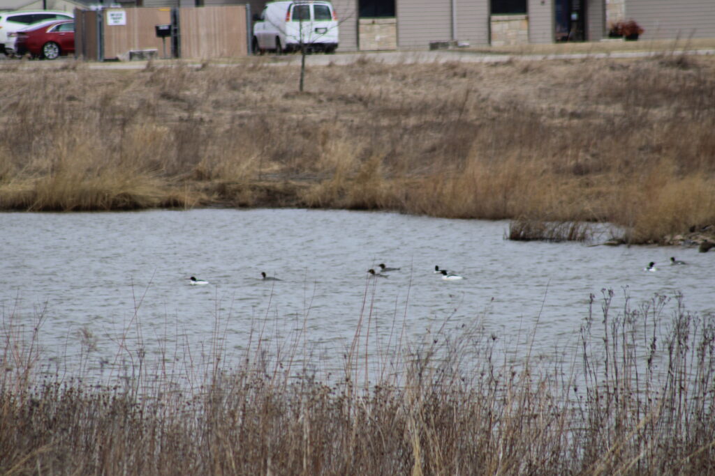
We decided to continue and almost immediately saw a quartet of male Mallards in the creek. We continued on after taking more pictures. Gulls continued to fly around and landed in the retention pond. Other birds flew by and I took more pictures to identify later. The identifications were a flock of Merganser Ducks, a Red Tailed Hawk, and another Blue Heron.
Reaching Edgewood Dr we had to choose again. Do we retrace our path or do we walk along Edgewood Dr to Ballard Dr and then return to our car? Knowing a Copper Rock Coffee House was at the corner of Edgewood and Ballard we chose the latter path.
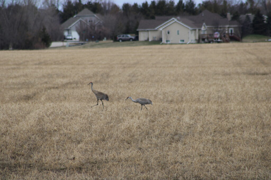
Before we started our trek along Edgewood we noticed a pair of Sand Hill Cranes in the fields north of us. My wife remarked about the strange dance the cranes were performing.
Most of the walk westward toward Ballard Dr was on the gravel next to the rural highway. The city or county have yet to connect the existing trails and sidewalks with a trail along Edgewood Dr. However as we reach the section of Edgewood Drive along Appleton North High School the safety of a side walk separated from the road returned.
In Wisconsin it is legal to walk along any road or county highway without a sidewalk. But pedestrians must use the left hand side of the road and move as far left when encountering a vehicle. I often find that joggers and other walkers have a tendency to walk on the right side of the road, even when a sidewalk is readily available, if it is inconvenient to them or are ignorant of the regulation.
While I doubt that any police officer would cite a pedestrian for not following these rules. It does provide some legal deference of vehicle operators if accidents occur. I can remember a case of a drunk driver getting away with running down a pair of kids walking because they were not properly walking as they should have been. So my point is to remind my readers to hike safely.
After visiting Copper Rock we started walking south along Ballard Dr. We returned to our car and ended our hike. Later I verified that this was a 6 mile hike.
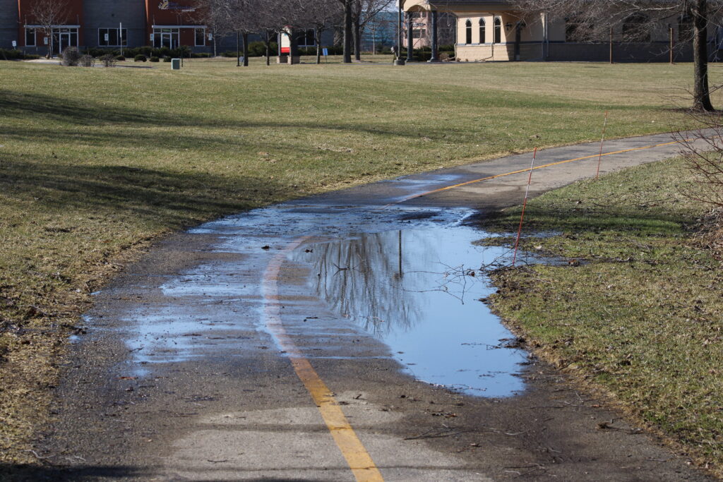
Though some of our hike was not on the official trail, the Apple Creek Trail is a well designed trail. With the exception of a few areas of the blacktop trail having puddles due to improper drainage. It is a trail we have traveled before and will again.
Please let me know if you have hiked on this trail or plan to in the future, in the comments below. Please be safe on any of your future planned or unplanned hikes. And thank you again for taking the time to read my blog and view my pictures.
I like the tree sparrow
Sorry tree swallow
The pic of the tree swallow is gorgeous. I also love the killdeer flying. Amazing shot.
I found the mating dance of the sandhill cranes comical but loved seeing it in real life.